
קובץ:Spain-2008-29-11.png

גודל התצוגה המקדימה הזאת: 696 × 599 פיקסלים. רזולוציות אחרות: 279 × 240 פיקסלים | 558 × 480 פיקסלים | 992 × 854 פיקסלים.
לקובץ המקורי (992 × 854 פיקסלים, גודל הקובץ: 400 ק"ב, סוג MIME: image/png)
| זהו קובץ שמקורו במיזם ויקישיתוף. תיאורו בדף תיאור הקובץ המקורי (בעברית) מוצג למטה. |
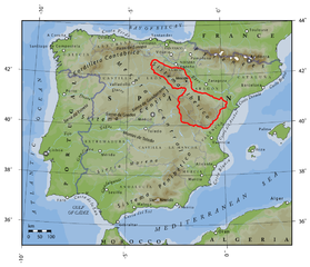
| תיאור | Topographical map of Spain. Author: Bas de Jong Sources: * U.S. National Geophysical Data Center (NGDC) * The Times Atlas of the World. 11th ed. London: Times Books, 2005. * "Spain." Encyclopædia Britannica from Encyclopædia Britannica Online. <http://www.search.eb.com/eb/article-70258> [Accessed February, 2006]. Sistema Ibérico - November 2008 |
| תאריך יצירה | (UTC) |
| מקור | |
| יוצר |
| זוהי תמונה מרוטשת, זאת אומרת שהתמונה שונתה בצורה דיגיטלית מהמקור. את התמונה המקורית ניתן לראות ב: Spain.png.
|
אני, בעל זכויות היוצרים על היצירה הזאת, מפרסם אותה בזאת תחת הרישיונות הבאים:
- הנכם רשאים:
- לשתף – להעתיק, להפיץ ולהעביר את העבודה
- לערבב בין עבודות – להתאים את העבודה
- תחת התנאים הבאים:
- ייחוס – יש לתת ייחוס הולם, לתת קישור לרישיון, ולציין אם נעשו שינויים. אפשר לעשות את זה בכל צורה סבירה, אבל לא בשום צורה שמשתמע ממנה שמעניק הרישיון תומך בך או בשימוש שלך.
- שיתוף זהה – אם תיצרו רמיקס, תשנו, או תבנו על החומר, חובה עליכם להפיץ את התרומות שלך לפי תנאי רישיון זהה או תואם למקור.

|
מוענקת בכך הרשות להעתיק, להפיץ או לשנות את המסמך הזה, לפי תנאי הרישיון לשימוש חופשי במסמכים של גנו, גרסה 1.2 או כל גרסה מאוחרת יותר שתפורסם על־ידי המוסד לתוכנה חופשית; ללא פרקים קבועים, ללא טקסט עטיפה קדמית וללא טקסט עטיפה אחורית. עותק של הרישיון כלול בפרק שכותרתו הרישיון לשימוש חופשי במסמכים של גנו. |
| הקובץ הזה מתפרסם לפי תנאי רישיון קריאייטיב קומונז ייחוס-שיתוף זהה 3.0 לא מותאם. | ||
| ||
| תבנית רישוי זו הוספה לקובץ כחלק מעדכון רישיון GFDL. |
הנכם מוזמנים לבחור את הרישיון הרצוי בעיניכם.
יומן העלאה מקורי
This image is a derivative work of the following images:
- Image:Spain.png licensed with Cc-by-2.5,2.0,1.0/en, Cc-by-sa-2.5,2.0,1.0, GFDL
- 2006-02-14T15:00:33Z Ζεύς 992x854 (389258 Bytes) me
Uploaded with derivativeFX
היסטוריית הקובץ
ניתן ללחוץ על תאריך/שעה כדי לראות את הקובץ כפי שנראה באותו זמן.
| תאריך/שעה | תמונה ממוזערת | ממדים | משתמש | הערה | |
|---|---|---|---|---|---|
| נוכחית | 04:15, 29 בנובמבר 2008 | | 854 × 992 (400 ק"ב) | FDV | {{Information |Description=Topographical map of Spain. Author: Bas de Jong Sources: * U.S. National Geophysical Data Center (NGDC) * The Times Atlas of the World. 11th ed. London: Times Books, 2005. * "Spain." Encyclopædia Britannica from Encyclopædi |
שימוש בקובץ
הדף הבא משתמש בקובץ הזה:
שימוש גלובלי בקובץ
אתרי הוויקי השונים הבאים משתמשים בקובץ זה:
- שימוש באתר an.wikipedia.org
- שימוש באתר ast.wikipedia.org
- שימוש באתר az.wikipedia.org
- שימוש באתר be.wikipedia.org
- שימוש באתר bg.wikipedia.org
- שימוש באתר ca.wikipedia.org
- שימוש באתר ca.wikibooks.org
- שימוש באתר ceb.wikipedia.org
- שימוש באתר cs.wikipedia.org
- שימוש באתר de.wikipedia.org
- שימוש באתר el.wikipedia.org
- שימוש באתר en.wikipedia.org
- שימוש באתר en.wiktionary.org
- שימוש באתר eo.wikipedia.org
- שימוש באתר es.wikipedia.org
- שימוש באתר et.wikipedia.org
- שימוש באתר eu.wikipedia.org
- שימוש באתר fi.wikipedia.org
- שימוש באתר fr.wikipedia.org
- שימוש באתר fr.wiktionary.org
- שימוש באתר hy.wikipedia.org
- שימוש באתר it.wikipedia.org
- שימוש באתר ja.wikipedia.org
- שימוש באתר kk.wikipedia.org
- שימוש באתר lt.wikipedia.org
- שימוש באתר nl.wikipedia.org
- שימוש באתר no.wikipedia.org
- שימוש באתר pl.wikipedia.org
- שימוש באתר pl.wiktionary.org
- שימוש באתר pt.wikipedia.org
- שימוש באתר ru.wikipedia.org
- שימוש באתר sh.wikipedia.org
- שימוש באתר simple.wikipedia.org
- שימוש באתר sl.wikipedia.org
- שימוש באתר sv.wikipedia.org
- שימוש באתר uk.wikipedia.org
- שימוש באתר www.wikidata.org
- שימוש באתר zh.wikipedia.org