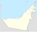
קובץ:United Arab Emirates adm location map.svg

גודל התצוגה המקדימה הזאת מסוג PNG של קובץ ה־SVG הזה: 697 × 599 פיקסלים. רזולוציות אחרות: 279 × 240 פיקסלים | 558 × 480 פיקסלים | 893 × 768 פיקסלים | 1,191 × 1,024 פיקסלים | 2,382 × 2,048 פיקסלים | 1,228 × 1,056 פיקסלים.
לקובץ המקורי (קובץ SVG, הגודל המקורי: 1,228 × 1,056 פיקסלים, גודל הקובץ: 150 ק"ב)
היסטוריית הקובץ
ניתן ללחוץ על תאריך/שעה כדי לראות את הקובץ כפי שנראה באותו זמן.
| תאריך/שעה | תמונה ממוזערת | ממדים | משתמש | הערה | |
|---|---|---|---|---|---|
| נוכחית | 01:54, 22 באפריל 2022 |  | 1,056 × 1,228 (150 ק"ב) | Spesh531 | Adding the little sliver of the newly demarcated Qatar-Saudi Arabia border |
| 10:43, 21 בספטמבר 2017 |  | 1,056 × 1,228 (150 ק"ב) | Túrelio | Reverted to version as of 15:12, 18 September 2017 (UTC), due to violation of Commons:Overwriting existing files | |
| 01:42, 21 בספטמבר 2017 |  | 1,056 × 1,228 (151 ק"ב) | Shahin | these three islands are belong to Iran not UAE by international recognition. you can't bulling someone and threat to blocking for your false editing. this is wiki and we edit with references not bullying | |
| 18:12, 18 בספטמבר 2017 |  | 1,056 × 1,228 (150 ק"ב) | NordNordWest | Reverted to version as of 17:50, 17 September 2017 (UTC); another change you will find your name at Commons:Administrators' noticeboard/User problems | |
| 18:08, 18 בספטמבר 2017 |  | 1,056 × 1,228 (151 ק"ב) | Shahin | Abu Musa, Greater Tunb and Lesser Tunb doesn't belong to U.A.E and they are not part of U.A.E soil | |
| 20:50, 17 בספטמבר 2017 |  | 1,056 × 1,228 (150 ק"ב) | NordNordWest | Reverted to version as of 07:43, 13 September 2017 (UTC) oh please | |
| 20:05, 17 בספטמבר 2017 |  | 1,056 × 1,228 (151 ק"ב) | Shahin | Reverted to version as of 21:07, 12 September 2017 (UTC) | |
| 10:43, 13 בספטמבר 2017 |  | 1,056 × 1,228 (150 ק"ב) | NordNordWest | Reverted to version as of 19:59, 4 April 2016 (UTC); see en:Greater and Lesser Tunbs | |
| 00:07, 13 בספטמבר 2017 |  | 1,056 × 1,228 (151 ק"ב) | Shahin | Abu Musa, Greater Tunb and Lesser Tunb doesn't belong to U.A.E | |
| 22:59, 4 באפריל 2016 |  | 1,056 × 1,228 (150 ק"ב) | NordNordWest | corr |
שימוש בקובץ
הדפים הבאים משתמשים בקובץ הזה:
- אבו דאבי
- אום אל-קיוין (עיר)
- איחוד האמירויות הערביות
- אל-עין
- אל מרדאמו
- גבול איחוד האמירויות הערביות–עומאן
- דובאי (עיר)
- דלמא (אי)
- חטא (דובאי)
- מגדל השמיים (אבו דאבי)
- מגדלי איתיחאד
- מלון ארמון האמירויות
- מנאמה (עג'מאן)
- מסגד שייח' זאיד
- מסדאר סיטי
- מסלול יאס מרינה
- מרכז הסחר העולמי אבו דאבי
- נחווה
- נמל התעופה הבין-לאומי דובאי
- נמל התעופה הבין-לאומי זאיד
- עג'מאן (עיר)
- פוג'יירה (עיר)
- ראס אל-ח'ימה (עיר)
- שארג'ה (עיר)
- שגרירות ישראל באבו דאבי
- תבנית:מפת מיקום/איחוד האמירויות הערביות
- טיוטה:בו טינה
שימוש גלובלי בקובץ
אתרי הוויקי השונים הבאים משתמשים בקובץ זה:
- שימוש באתר an.wikipedia.org
- שימוש באתר de.wikipedia.org
- Burj al Arab
- Flughafen Dubai
- Burj Khalifa
- Dubai Mall
- DubaiLand
- Emirates Towers
- Flughafen Abu Dhabi
- Flughafen Schardscha
- 21st Century Tower
- Dubai Internet City
- Flughafen Dubai-World Central
- 23 Marina
- Rose Tower
- Nakheel Tower
- Junioren-Fußballweltmeisterschaft 2003
- Vorlage:Positionskarte Vereinigte Arabische Emirate
- Millennium Tower (Dubai)
- Pentominium
- Flughafen Al-Ain
- Elite Residence
- Flughafen Ra’s al-Chaima
- Masdar City
- Ferrari World (Themenpark)
- Almas Tower
- Emirates Crown
- Yas Marina Circuit
- FIFA-Klub-Weltmeisterschaft 2009
- Dubai Classic
- The Address Downtown Dubai
- HHHR Tower
- The Index
- Dream Dubai Marina
- Princess Tower
- Al Kazim Towers
- Ahmed Abdul Rahim Al Attar Tower
- Mina Al Arab
- Arab Cup of Ice Hockey
- JW Marriott Marquis Hotel Dubai
- Zayed-Sports-City-Stadion
- Al-Jazira-Mohammed-Bin-Zayed-Stadion
- Al Marjan Island
- DAMAC Heights
- Al-Nahyan-Stadion
- Scheich-Khalifa-International-Stadion
- The Torch
- Al Yaqoub Tower


