
קובץ:Rincon Mountain District map.png
גודל התצוגה המקדימה הזאת: 800 × 467 פיקסלים. רזולוציות אחרות: 320 × 187 פיקסלים | 640 × 374 פיקסלים | 1,024 × 598 פיקסלים | 1,599 × 934 פיקסלים.
לקובץ המקורי (1,599 × 934 פיקסלים, גודל הקובץ: 344 ק"ב, סוג MIME: image/png)
| זהו קובץ שמקורו במיזם ויקישיתוף. תיאורו בדף תיאור הקובץ המקורי (בעברית) מוצג למטה. |
| תיאור |
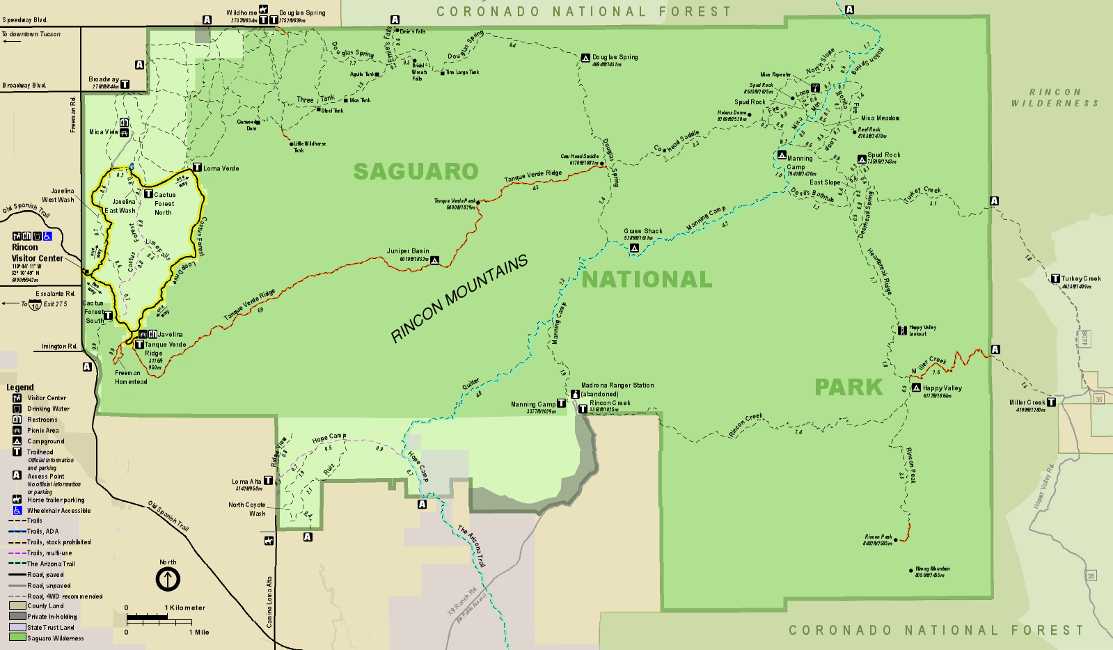
English: Map of the Rincon Mountain District of Saguaro National Park in the U.S. state of Arizona |
|||
| תאריך יצירה | (date of upload); unknown date of creation of the original | |||
| מקור | official park map | |||
| יוצר | National Park Service; converted from PDF to PNG format by User:Finetooth using GNU Image Manipulation Program (GIMP) software | |||
| אישורים והיתרים (שימוש חוזר בקובץ זה) |
|
היסטוריית הקובץ
ניתן ללחוץ על תאריך/שעה כדי לראות את הקובץ כפי שנראה באותו זמן.
| תאריך/שעה | תמונה ממוזערת | ממדים | משתמש | הערה | |
|---|---|---|---|---|---|
| נוכחית | 00:06, 13 ביוני 2017 | | 934 × 1,599 (344 ק"ב) | Finetooth | {{Information |Description ={{en|1=Map of the Rincon Mountain District of Saguaro National Park in the U.S. state of Arizona}} |Source =[https://www.nps.gov/sagu/planyourvisit/upload/sentinel_2013_rmd.pdf official park map] |Author =... |
שימוש בקובץ
הדף הבא משתמש בקובץ הזה:
שימוש גלובלי בקובץ
אתרי הוויקי השונים הבאים משתמשים בקובץ זה:
- שימוש באתר ca.wikipedia.org
- שימוש באתר en.wikipedia.org