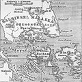
קובץ:Map of Singapore.jpg
Map_of_Singapore.jpg (353 × 354 פיקסלים, גודל הקובץ: 43 ק"ב, סוג MIME: image/jpeg)
היסטוריית הקובץ
ניתן ללחוץ על תאריך/שעה כדי לראות את הקובץ כפי שנראה באותו זמן.
| תאריך/שעה | תמונה ממוזערת | ממדים | משתמש | הערה | |
|---|---|---|---|---|---|
| נוכחית | 02:36, 6 בדצמבר 2006 |  | 354 × 353 (43 ק"ב) | Electionworld | {{ew|en|WhistperToMe}} 1888 German map of Singapore {{PD-old}} |
שימוש בקובץ
הדף הבא משתמש בקובץ הזה:
שימוש גלובלי בקובץ
אתרי הוויקי השונים הבאים משתמשים בקובץ זה:
- שימוש באתר ast.wikipedia.org
- שימוש באתר ca.wikipedia.org
- שימוש באתר da.wikipedia.org
- שימוש באתר de.wikipedia.org
- שימוש באתר en.wikipedia.org
- שימוש באתר eo.wikipedia.org
- שימוש באתר es.wikipedia.org
- שימוש באתר eu.wikipedia.org
- שימוש באתר fr.wikipedia.org
- שימוש באתר gl.wikipedia.org
- שימוש באתר hi.wikipedia.org
- שימוש באתר ko.wikipedia.org
- שימוש באתר ms.wikipedia.org
- שימוש באתר nl.wikipedia.org
- שימוש באתר pnb.wikipedia.org
- שימוש באתר simple.wikipedia.org
- שימוש באתר th.wikipedia.org
- שימוש באתר tr.wikipedia.org
- שימוש באתר zh.wikipedia.org


