
קובץ:King Range National Conservation Area (18967577236).jpg

לקובץ המקורי (2,904 × 1,954 פיקסלים, גודל הקובץ: 7.74 מ"ב, סוג MIME: image/jpeg)
| זהו קובץ שמקורו במיזם ויקישיתוף. תיאורו בדף תיאור הקובץ המקורי (בעברית) מוצג למטה. |
.jpg)
.jpg?uselang=he)
תקציר
| תיאור |
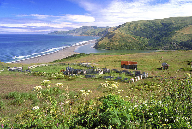
A spectacular meeting of land and sea is certainly the dominant feature of King Range National Conservation Area. Mountains seem to thrust straight out of the surf; a precipitous rise rarely surpassed on the continental U.S. coastline. King Peak, the highest point at 4,088 feet, is only three miles from the ocean. The King Range NCA covers 68,000 acres and extends along 35 miles of coastline between the mouth of the Mattole River and Sinkyone Wilderness State Park. Here the landscape was too rugged for highway building, forcing State Highway 1 and U.S. 101 inland. The remote region is known as California's Lost Coast, and is only accessed by a few back roads. The recreation opportunities here are as diverse as the landscape. The Douglas-fir peaks attract hikers, hunters, campers and mushroom collectors, while the coast beckons to surfers, anglers, beachcombers, and abalone divers to name a few. For more information visit: www.blm.gov/ca/st/en/fo/arcata/kingrange/index.html Photos/Videos: Bob Wick, BLM |
| תאריך יצירה | |
| מקור | King Range National Conservation Area |
| יוצר | Bureau of Land Management |
רישיון
- הנכם רשאים:
- לשתף – להעתיק, להפיץ ולהעביר את העבודה
- לערבב בין עבודות – להתאים את העבודה
- תחת התנאים הבאים:
- ייחוס – יש לתת ייחוס הולם, לתת קישור לרישיון, ולציין אם נעשו שינויים. אפשר לעשות את זה בכל צורה סבירה, אבל לא בשום צורה שמשתמע ממנה שמעניק הרישיון תומך בך או בשימוש שלך.
| This image was originally posted to Flickr by mypubliclands at https://flickr.com/photos/91981596@N06/18967577236. It was reviewed on 4 באוגוסט 2015 by FlickreviewR and was confirmed to be licensed under the terms of the cc-by-2.0. |
| This image is a work of a Bureau of Land Management* employee, taken or made as part of that person's official duties. As a work of the U.S. federal government, the image is in the public domain in the United States. *or predecessor organization |
היסטוריית הקובץ
ניתן ללחוץ על תאריך/שעה כדי לראות את הקובץ כפי שנראה באותו זמן.
| תאריך/שעה | תמונה ממוזערת | ממדים | משתמש | הערה | |
|---|---|---|---|---|---|
| נוכחית | 21:39, 4 באוגוסט 2015 | | 1,954 × 2,904 (7.74 מ"ב) | Wilfredor | Transferred from Flickr via Flickr2Commons |
שימוש בקובץ
הדף הבא משתמש בקובץ הזה:
שימוש גלובלי בקובץ
אתרי הוויקי השונים הבאים משתמשים בקובץ זה:
- שימוש באתר en.wikipedia.org
.jpg)