
קובץ:Delaware Basin map.PNG
גודל התצוגה המקדימה הזאת: 800 × 506 פיקסלים. רזולוציות אחרות: 320 × 202 פיקסלים | 640 × 405 פיקסלים | 1,160 × 734 פיקסלים.
לקובץ המקורי (1,160 × 734 פיקסלים, גודל הקובץ: 123 ק"ב, סוג MIME: image/png)
| זהו קובץ שמקורו במיזם ויקישיתוף. תיאורו בדף תיאור הקובץ המקורי (בעברית) מוצג למטה. |
תקציר
| תיאור |
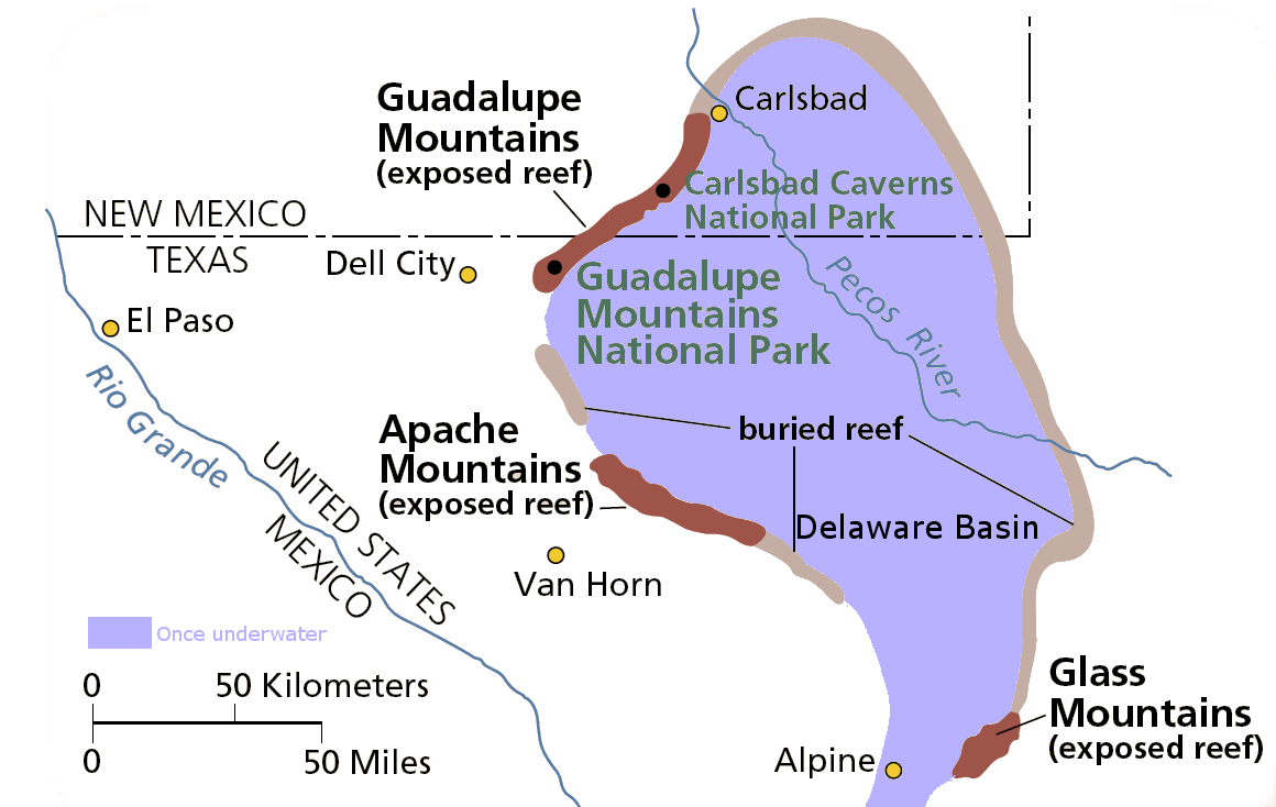
English: Map of the Delaware Basin — a geologic depositional and structural basin in West Texas and southeastern New Mexico.
|
| תאריך יצירה | תאריך בלתי־ידוע |
| מקור | נוצר על־ידי מעלה היצירה |
| יוצר | National Park Service |
| אישורים והיתרים (שימוש חוזר בקובץ זה) |
From pdf linked from http://www.nps.gov/gumo/naturescience/geologicformations.htm Edited using the GIMP. I place those edits in the public domain. |
רישיון
| This image or media file contains material based on a work of a National Park Service employee, created as part of that person's official duties. As a work of the U.S. federal government, such work is in the public domain in the United States. See the NPS website and NPS copyright policy for more information. |
היסטוריית הקובץ
ניתן ללחוץ על תאריך/שעה כדי לראות את הקובץ כפי שנראה באותו זמן.
| תאריך/שעה | תמונה ממוזערת | ממדים | משתמש | הערה | |
|---|---|---|---|---|---|
| נוכחית | 05:39, 1 באוגוסט 2007 | | 734 × 1,160 (123 ק"ב) | Mav | from pdf linked from http://www.nps.gov/gumo/naturescience/geologicformations.htm Edited using the GIMP. I place those edits in the public domain. |
שימוש בקובץ
הדף הבא משתמש בקובץ הזה:
שימוש גלובלי בקובץ
אתרי הוויקי השונים הבאים משתמשים בקובץ זה:
- שימוש באתר en.wikipedia.org
- שימוש באתר es.wikipedia.org
- שימוש באתר it.wikipedia.org
- שימוש באתר uk.wikipedia.org
- שימוש באתר www.wikidata.org