
קובץ:C83165s1 Ant.Map Mount Rabot.jpg
גודל התצוגה המקדימה הזאת: 711 × 599 פיקסלים. רזולוציות אחרות: 285 × 240 פיקסלים | 569 × 480 פיקסלים | 911 × 768 פיקסלים | 1,215 × 1,024 פיקסלים | 2,429 × 2,048 פיקסלים | 3,845 × 3,242 פיקסלים.
לקובץ המקורי (3,845 × 3,242 פיקסלים, גודל הקובץ: 1.82 מ"ב, סוג MIME: image/jpeg)
| זהו קובץ שמקורו במיזם ויקישיתוף. תיאורו בדף תיאור הקובץ המקורי (בעברית) מוצג למטה. |
| תיאור |
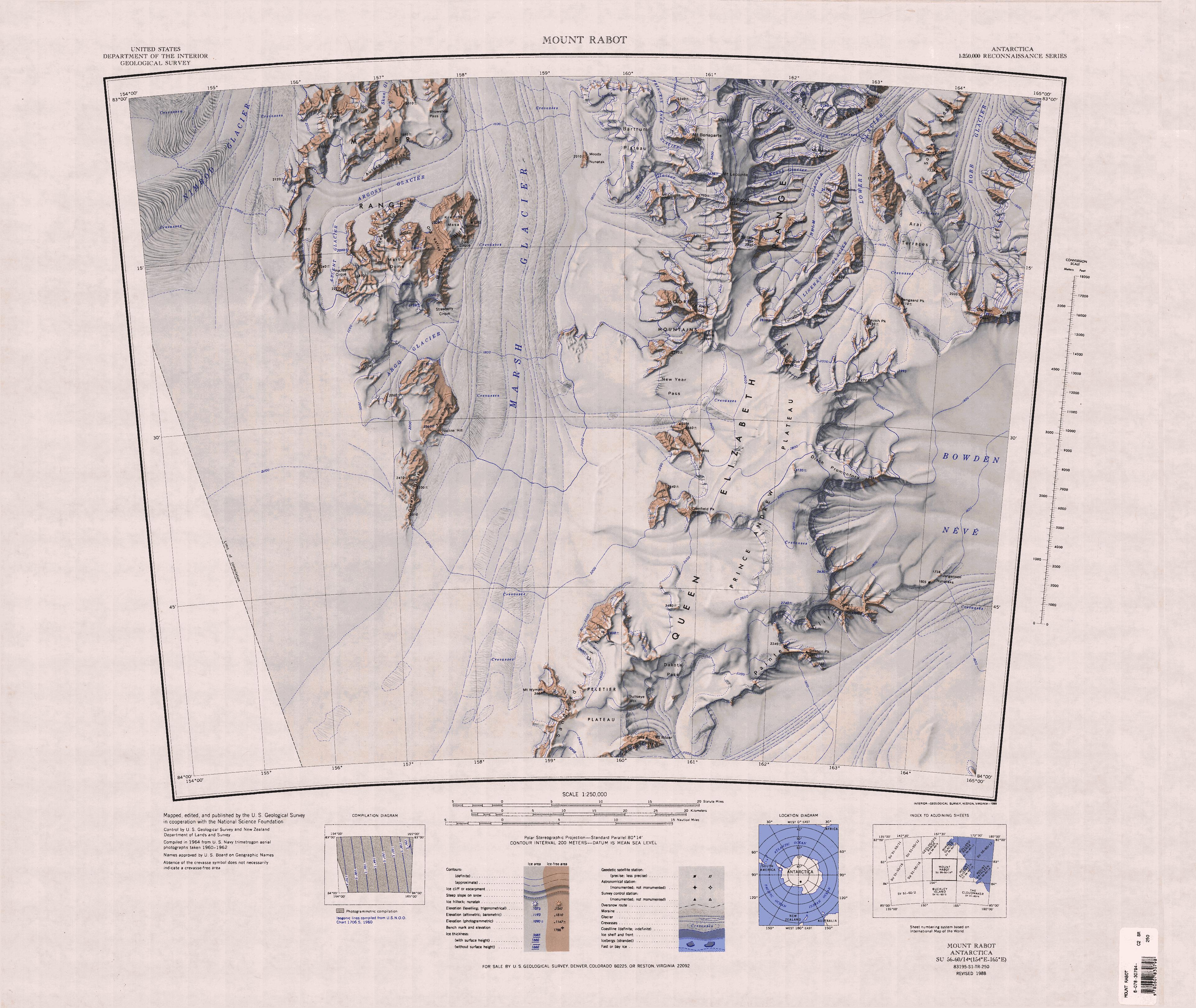
English: Map of Antarctica by the United States Antarctic Resource Center of the US Geological Society. |
| מקור | USGS |
| יוצר | USGS |
This image is in the public domain in the United States because it only contains materials that originally came from the United States Geological Survey, an agency of the United States Department of the Interior. For more information, see the official USGS copyright policy.
|
היסטוריית הקובץ
ניתן ללחוץ על תאריך/שעה כדי לראות את הקובץ כפי שנראה באותו זמן.
| תאריך/שעה | תמונה ממוזערת | ממדים | משתמש | הערה | |
|---|---|---|---|---|---|
| נוכחית | 15:58, 4 באפריל 2005 | | 3,242 × 3,845 (1.82 מ"ב) | Achim Raschka | Map of Antarctica by the United States Antarctic Ressource Center of the US Geological Society. {{PD-US}} Copyrights and Trademarks USGS-authored or produced data and information are in the public domain. While the content of most USGS web pages is in th |
שימוש בקובץ
הדפים הבאים משתמשים בקובץ הזה:
שימוש גלובלי בקובץ
אתרי הוויקי השונים הבאים משתמשים בקובץ זה:
- שימוש באתר bg.wikipedia.org
- שימוש באתר ceb.wikipedia.org
- שימוש באתר de.wikipedia.org
- Queen Elizabeth Range
- Robb-Gletscher
- Bowden-Firnfeld
- Marsh-Gletscher
- Miller Range
- Peletier-Plateau
- New Year Pass
- Argo-Gletscher
- Macdonald Bluffs
- Argosy-Gletscher
- Kreiling Mesa
- Ascent-Gletscher
- Milan Ridge
- Orr Peak
- Aurora Heights
- Bartrum-Plateau
- Dike Cirque
- Greene Ridge
- Martin Dome
- Hockey Cirque
- Lookout Dome
- Moody-Nunatak
- Ong Valley
- Snowshoe Pass
- Ross-Orogen
- Nimrod-Orogenese
- Geologie Ostantarktikas
- שימוש באתר en.wikipedia.org
- שימוש באתר it.wikipedia.org