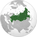
קובץ:Union State (Crimea and eastern Ukraine disputed).svg

גודל התצוגה המקדימה הזאת מסוג PNG של קובץ ה־SVG הזה: 541 × 541 פיקסלים. רזולוציות אחרות: 240 × 240 פיקסלים | 480 × 480 פיקסלים | 768 × 768 פיקסלים | 1,024 × 1,024 פיקסלים | 2,048 × 2,048 פיקסלים.
לקובץ המקורי (קובץ SVG, הגודל המקורי: 541 × 541 פיקסלים, גודל הקובץ: 442 ק"ב)
היסטוריית הקובץ
ניתן ללחוץ על תאריך/שעה כדי לראות את הקובץ כפי שנראה באותו זמן.
| תאריך/שעה | תמונה ממוזערת | ממדים | משתמש | הערה | |
|---|---|---|---|---|---|
| נוכחית | 16:25, 24 בפברואר 2023 |  | 541 × 541 (442 ק"ב) | Stjn | Reverted to version as of 21:56, 3 October 2022 (UTC): although Kuril Islands are also disputed, they don't have the same level of significance as occupied territories of Ukraine, so it's better to keep a separate map with them for that use case |
| 05:59, 13 בפברואר 2023 |  | 537 × 536 (440 ק"ב) | Jamie Eilat | Changed color of disputed Kuril Islands dispute to match the disputed annexation of east Ukraine. | |
| 00:56, 4 באוקטובר 2022 |  | 541 × 541 (442 ק"ב) | Jazzertyy | Uploaded own work with UploadWizard |
שימוש בקובץ
הדף הבא משתמש בקובץ הזה:
שימוש גלובלי בקובץ
אתרי הוויקי השונים הבאים משתמשים בקובץ זה:
- שימוש באתר ast.wikipedia.org
- שימוש באתר bg.wikipedia.org
- שימוש באתר ca.wikipedia.org
- שימוש באתר fi.wikipedia.org
- שימוש באתר fr.wikipedia.org
- שימוש באתר ru.wikipedia.org
- שימוש באתר ru.wikinews.org
- שימוש באתר sv.wikipedia.org
- שימוש באתר vi.wikipedia.org
- שימוש באתר www.wikidata.org
