
קובץ:USATopographicalMap.jpg
גודל התצוגה המקדימה הזאת: 800 × 527 פיקסלים. רזולוציות אחרות: 320 × 211 פיקסלים | 640 × 422 פיקסלים | 1,024 × 674 פיקסלים | 1,280 × 843 פיקסלים | 2,560 × 1,686 פיקסלים | 3,199 × 2,107 פיקסלים.
לקובץ המקורי (3,199 × 2,107 פיקסלים, גודל הקובץ: 11.19 מ"ב, סוג MIME: image/jpeg)
| זהו קובץ שמקורו במיזם ויקישיתוף. תיאורו בדף תיאור הקובץ המקורי (בעברית) מוצג למטה. |
תקציר
| תיאור |
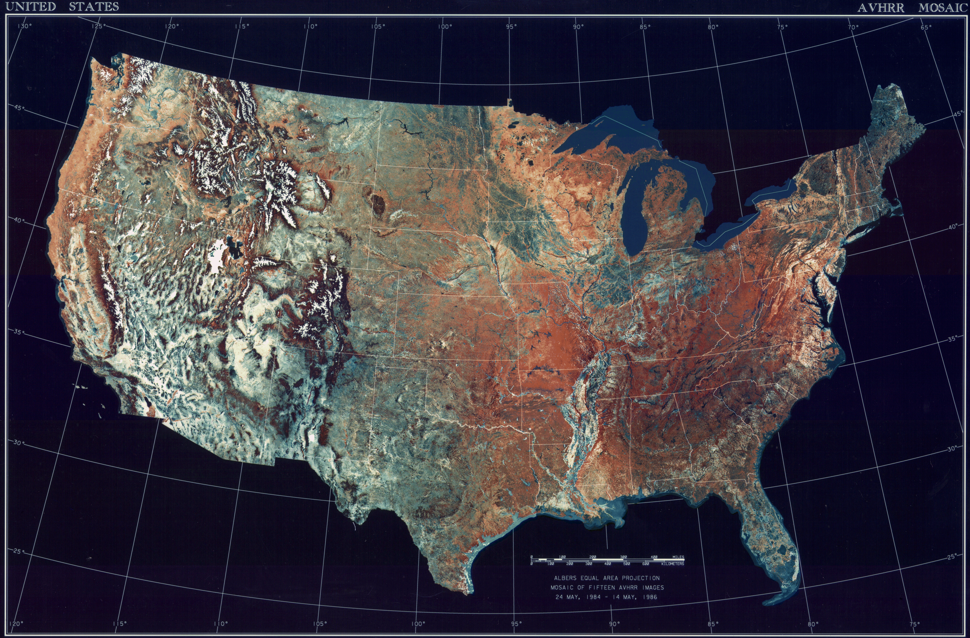
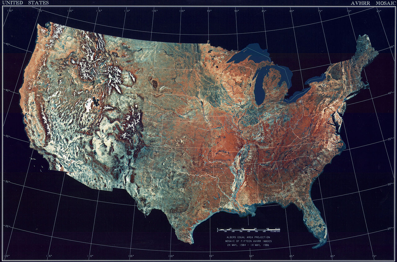
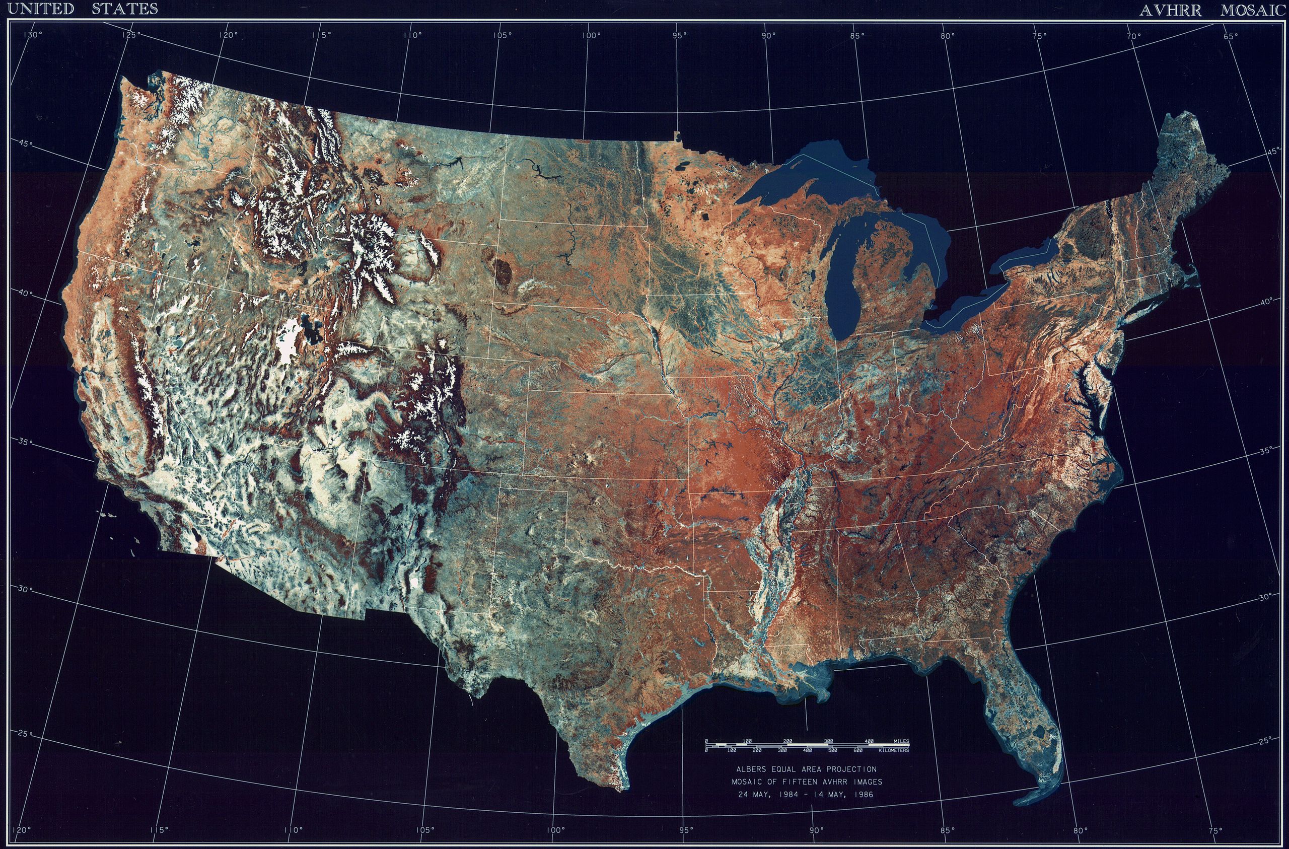
Deutsch: Satellitenbild der 48 Zentralstaaten der Vereinigten Staaten.
|
| תאריך יצירה | בין 24 במאי 1984 ו- 14 במאי 1986 |
| מקור | National Climactic Data Center/NOAA Satellite and Information Service |
| יוצר | U.S. Dept. of Commerce/National Climactic Data Center/NOAA Satellite and Information Service |
רישיון
This image is in the public domain because it contains materials that originally came from the U.S. National Oceanic and Atmospheric Administration, taken or made as part of an employee's official duties.
|
היסטוריית הקובץ
ניתן ללחוץ על תאריך/שעה כדי לראות את הקובץ כפי שנראה באותו זמן.
| תאריך/שעה | תמונה ממוזערת | ממדים | משתמש | הערה | |
|---|---|---|---|---|---|
| נוכחית | 11:06, 25 באוקטובר 2013 | | 2,107 × 3,199 (11.19 מ"ב) | McZusatz | compression (uploaded using chunked upload script) |
| 20:33, 4 במרץ 2009 |  | 2,107 × 3,199 (450 ק"ב) | File Upload Bot (Magnus Manske) | {{BotMoveToCommons|en.wikipedia|year={{subst:CURRENTYEAR}}|month={{subst:CURRENTMONTHNAME}}|day={{subst:CURRENTDAY}}}} {{Information |Description={{en|Topographical map of the United States}} |Source=Transferred from [http://en.wikipedia.org en.wikipedia |
שימוש בקובץ
הדף הבא משתמש בקובץ הזה:
שימוש גלובלי בקובץ
אתרי הוויקי השונים הבאים משתמשים בקובץ זה:
- שימוש באתר ar.wikipedia.org
- שימוש באתר arz.wikipedia.org
- שימוש באתר ceb.wikipedia.org
- שימוש באתר de.wikipedia.org
- שימוש באתר el.wikipedia.org
- שימוש באתר en.wikipedia.org
- שימוש באתר es.wikipedia.org
- שימוש באתר fa.wikipedia.org
- שימוש באתר fr.wikipedia.org
- שימוש באתר fy.wikipedia.org
- שימוש באתר gu.wikipedia.org
- שימוש באתר ia.wikipedia.org
- שימוש באתר incubator.wikimedia.org
- שימוש באתר kn.wikipedia.org
- שימוש באתר la.wikipedia.org
- שימוש באתר lt.wikipedia.org
- שימוש באתר mnw.wikipedia.org
- שימוש באתר ms.wikipedia.org
- שימוש באתר my.wikipedia.org
- שימוש באתר pap.wikipedia.org
- שימוש באתר sq.wikipedia.org
- שימוש באתר sv.wikipedia.org
- שימוש באתר sw.wikipedia.org
- שימוש באתר ta.wikipedia.org
- שימוש באתר tcy.wikipedia.org
- שימוש באתר th.wikipedia.org
- שימוש באתר tl.wikipedia.org
- שימוש באתר uk.wikipedia.org
- שימוש באתר www.wikidata.org
- שימוש באתר yo.wikipedia.org