
קובץ:Surface map of the United States October 30 1991.png
גודל התצוגה המקדימה הזאת: 768 × 599 פיקסלים. רזולוציות אחרות: 308 × 240 פיקסלים | 615 × 480 פיקסלים | 984 × 768 פיקסלים | 1,138 × 888 פיקסלים.
לקובץ המקורי (1,138 × 888 פיקסלים, גודל הקובץ: 2.07 מ"ב, סוג MIME: image/png)
| זהו קובץ שמקורו במיזם ויקישיתוף. תיאורו בדף תיאור הקובץ המקורי (בעברית) מוצג למטה. |
תקציר
| תיאור |
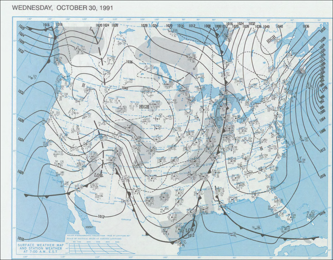
English: Surface map of the United States on October 30, 1991
http://docs.lib.noaa.gov/rescue/dwm/1991 |
| מקור | NOAA |
| יוצר | NOAA |
רישיון
This image is in the public domain because it contains materials that originally came from the U.S. National Oceanic and Atmospheric Administration, taken or made as part of an employee's official duties.
|
יומן העלאה מקורי
תיאור הקובץ המקורי נמצא כאן. כל שמות המשתמשים הבאים מתייחסים ל-en.wikipedia.
Upload date | User | Bytes | Dimensions | Comment
- 2007-09-03 20:51 (UTC) | WxGopher | 2170097 (bytes) | 1138×888 | ==Summary== Surface map of the United States on [[October 30]], [[1999]] http://docs.lib.noaa.gov/rescue/dwm/1991 ==Licensing== {{PD-USGov-NOAA}} [[Category:Minnesota maps]]
היסטוריית הקובץ
ניתן ללחוץ על תאריך/שעה כדי לראות את הקובץ כפי שנראה באותו זמן.
| תאריך/שעה | תמונה ממוזערת | ממדים | משתמש | הערה | |
|---|---|---|---|---|---|
| נוכחית | 21:10, 17 בספטמבר 2011 | | 888 × 1,138 (2.07 מ"ב) | SreeBot | (Original text) : ==Summary== Surface map of the United States on October 30, 1999 http://docs.lib.noaa.gov/rescue/dwm/1991 ==Licensing== {{PD-USGov-NOAA}} Category:Minnesota maps |
שימוש בקובץ
הדף הבא משתמש בקובץ הזה:
שימוש גלובלי בקובץ
אתרי הוויקי השונים הבאים משתמשים בקובץ זה:
- שימוש באתר en.wikipedia.org