
קובץ:Plan de Paris 1705 BNF07710700.png
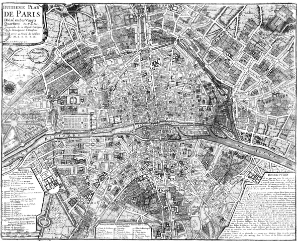
גודל התצוגה המקדימה הזאת: 739 × 600 פיקסלים. רזולוציות אחרות: 296 × 240 פיקסלים | 591 × 480 פיקסלים | 946 × 768 פיקסלים | 1,261 × 1,024 פיקסלים | 2,523 × 2,048 פיקסלים | 3,890 × 3,158 פיקסלים.
לקובץ המקורי (3,890 × 3,158 פיקסלים, גודל הקובץ: 15.89 מ"ב, סוג MIME: image/png)
| זהו קובץ שמקורו במיזם ויקישיתוף. תיאורו בדף תיאור הקובץ המקורי (בעברית) מוצג למטה. |
תקציר
| יוצר |
|
||||||||||||||||||||
| תיאור |
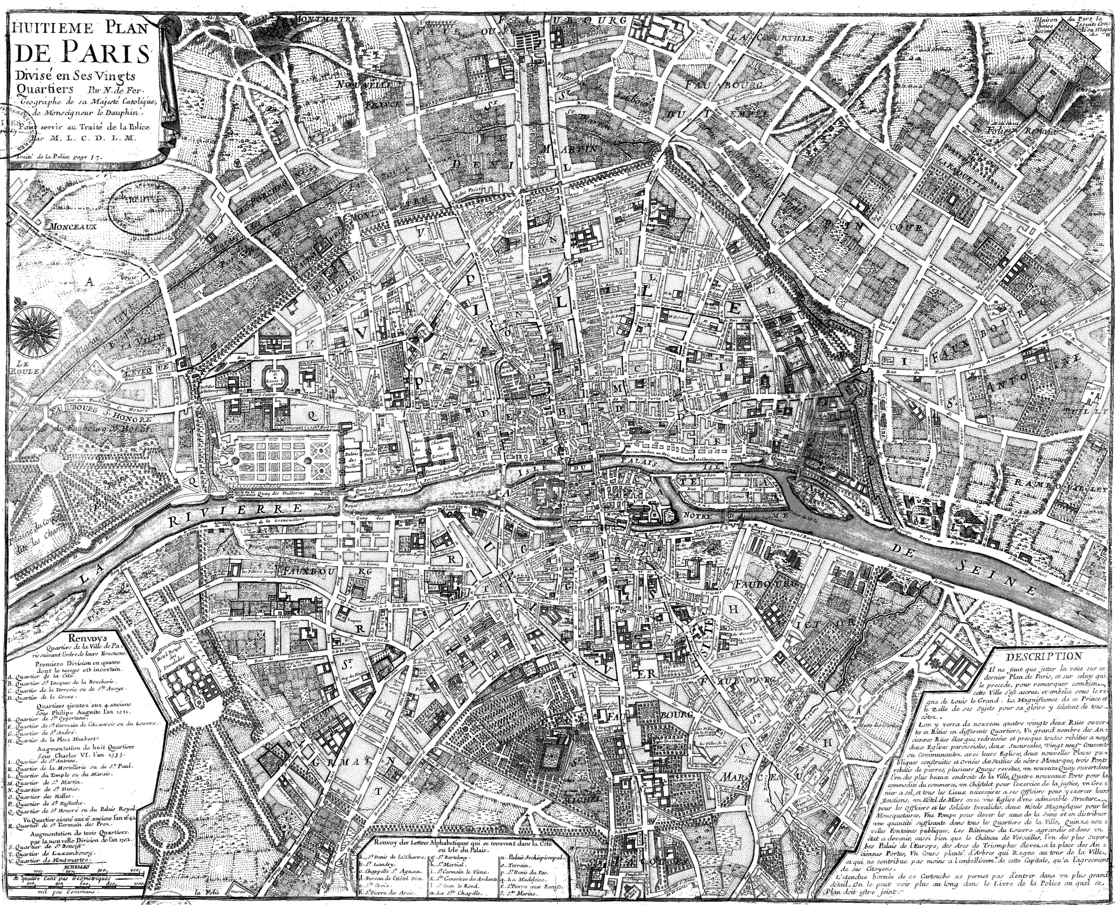
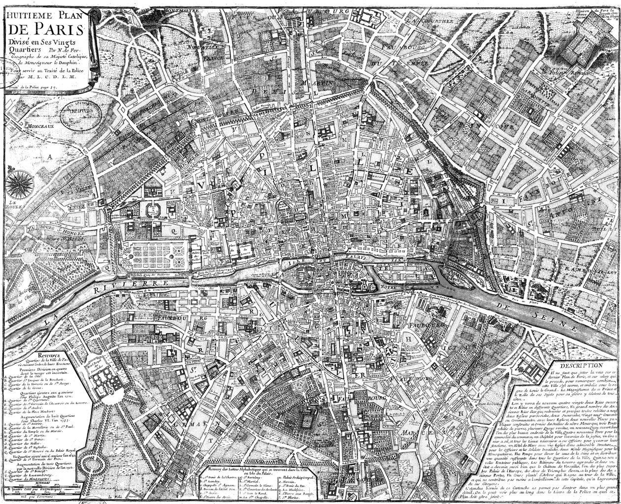
Français : Huitième plan de Paris divisé en ses vingts quartiers [Image fixe numérisée] / par N. de Fer Publication : Paris, 1705 Description matérielle : 1 carte ; 44,5 x 54,5 cm Collection : Collection d'Anville ; 00808 Note(s) : Cote : Ge DD 2987 (808) BNF Richelieu Cartes et Plans Reprod. 85 C 125661 ; Reprod. Sc 87/660 . - Légende et description en marge gauche et droite. Carte "pour servir au traité de la Police par M.L.C.D.L.M. Traité de la Police p. 87" Sujet(s) : Paris (France) -- Quartiers anciens Notice n° : FRBNF38638263 |
||||||||||||||||||||
| תאריך יצירה | 1705 | ||||||||||||||||||||
| מקור/צלם | Gallica | ||||||||||||||||||||
| גרסאות אחרות |
|
||||||||||||||||||||


| Open this image as an overlay in Google Earth (Google Maps, Bing) | (Help|Source) |
רישיון
|
יצירה זו נמצאת בנחלת הכלל במדינת המקור ובמדינות אחרות בהם תקופת זכויות היוצרים היא משך חיי היוצר ו-100 שנה (או פחות) מפטירתו.
| |
| הקובץ הזה זוהה כקובץ חופשי מכל מגבלה ידועה תחת חוק זכויות היוצרים, כולל כל הזכויות הקשורות והסמוכות. | |
| Previous public domain rationale, no longer applicable | ||
|---|---|---|
|
היסטוריית הקובץ
ניתן ללחוץ על תאריך/שעה כדי לראות את הקובץ כפי שנראה באותו זמן.
| תאריך/שעה | תמונה ממוזערת | ממדים | משתמש | הערה | |
|---|---|---|---|---|---|
| נוכחית | 12:20, 9 ביוני 2008 | | 3,158 × 3,890 (15.89 מ"ב) | Yann | reduce to below 12.5 Mpx, otherwise it will never display with Wikimedia limits. Nothing is lost (see history for the complete version, or the reference link) |
| 23:47, 22 בספטמבר 2005 |  | 3,396 × 4,183 (2.76 מ"ב) | David.Monniaux | Map of Paris in 1705 Type : image fixe, monographie Titre(s) : Huitième plan de Paris divisé en ses vingts quartiers [Image fixe numérisée] / par N. de Fer Publication : Paris, 1705 Description matérielle : 1 carte ; 44,5 x 54,5 cm Colle |
שימוש בקובץ
הדפים הבאים משתמשים בקובץ הזה:
שימוש גלובלי בקובץ
אתרי הוויקי השונים הבאים משתמשים בקובץ זה:
- שימוש באתר ar.wikipedia.org
- שימוש באתר en.wikipedia.org
- שימוש באתר fr.wikipedia.org
- שימוש באתר gl.wikipedia.org
- שימוש באתר hu.wikipedia.org
- שימוש באתר it.wikipedia.org
- שימוש באתר ja.wikipedia.org
- שימוש באתר ko.wikipedia.org
- שימוש באתר nl.wikipedia.org
- שימוש באתר pl.wikipedia.org
- שימוש באתר pnb.wikipedia.org
- שימוש באתר ur.wikipedia.org