
קובץ:LaIlustracionArgentina.jpg

לקובץ המקורי (4,635 × 3,576 פיקסלים, גודל הקובץ: 2.29 מ"ב, סוג MIME: image/jpeg)
| זהו קובץ שמקורו במיזם ויקישיתוף. תיאורו בדף תיאור הקובץ המקורי (בעברית) מוצג למטה. |
תקציר
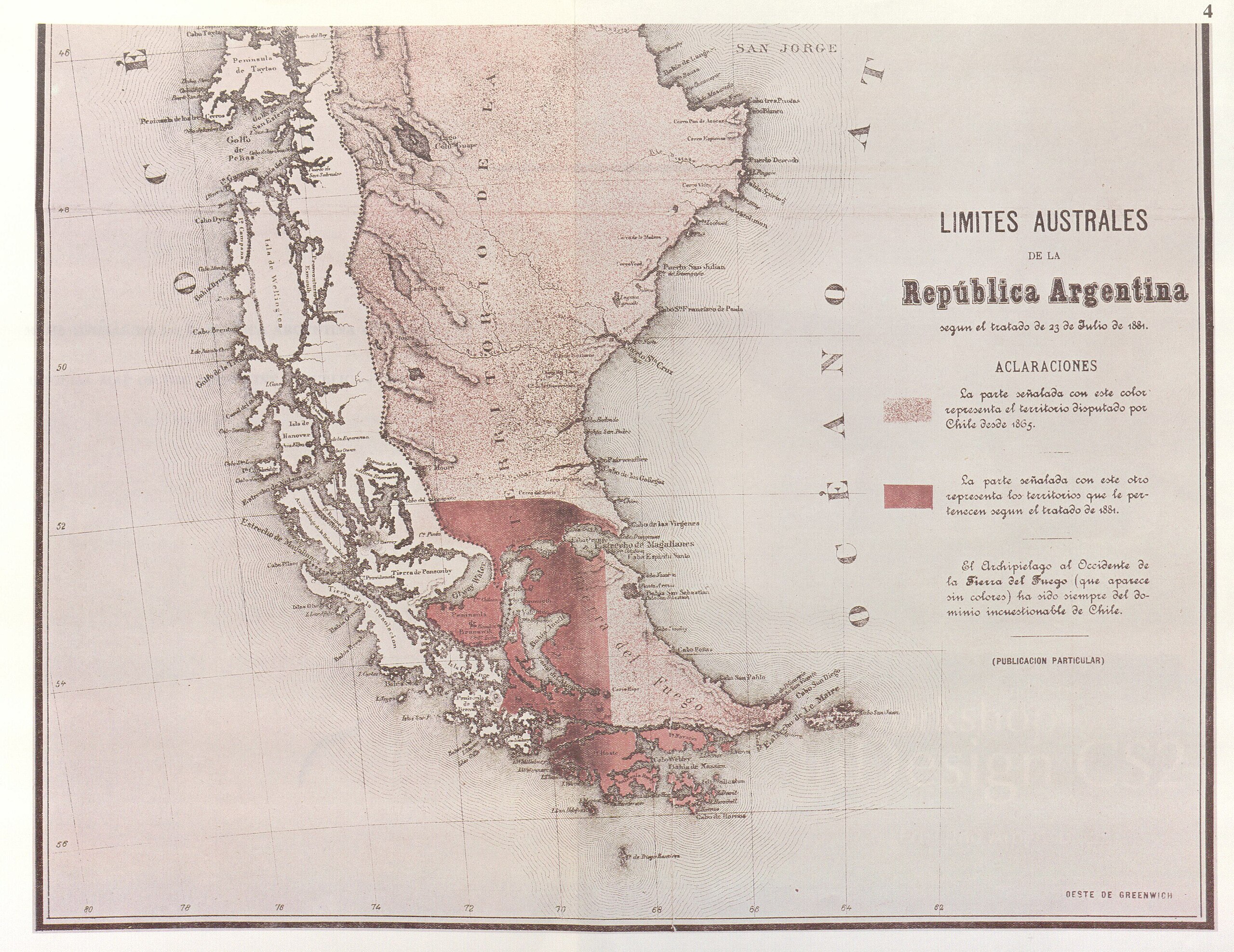
| תיאור | Parcial reproduction of the first argentinian map showing the boundaries laid down in the Boundary Treaty of 23 July 1881, appeared in "La Ilustracion Argentina" issue of 10 November 1881 in Buenos Aires. The copy reproduced here is one handed to the British Minister Plenipontentiary in Buenos Aires by Dr. Bernardo de Irigoyen, Argentine Minister of Forein Affairs who negotiated and signed the Boundary Treaty. The original is located in the official British Archives. The British Minister sent it to his Government with the comment that the dark shaded area "comprising the Strait of Magellan, half of Tierra del Fuego and all the southern islands, represent was actually has been ceded to Chile by the recent Treaty." | ||||
| תאריך יצירה | |||||
| מקור | Relaciones Chileno-Argentinas, La controversia del Beagle, edited by chilean Foreign Affairs, Geneve, Switzerland, 1979 | ||||
| יוצר | from magazin "La Ilustracion argentina" | ||||
| אישורים והיתרים (שימוש חוזר בקובץ זה) |
|
||||
היסטוריית הקובץ
ניתן ללחוץ על תאריך/שעה כדי לראות את הקובץ כפי שנראה באותו זמן.
| תאריך/שעה | תמונה ממוזערת | ממדים | משתמש | הערה | |
|---|---|---|---|---|---|
| נוכחית | 22:32, 3 בנובמבר 2007 | | 3,576 × 4,635 (2.29 מ"ב) | Keysanger | {{Information |Description=Parcial reproduction of the first argentinian map showing the boundaries laid down in the Boundary Treaty of 23 July 1881, appeared in "La Ilustracion Argentina" issue of 10 November 1881 in Buenos Aires. The copy reproduced her |
| 23:13, 18 ביוני 2007 |  | 1,371 × 1,836 (545 ק"ב) | Keysanger | {{Information |Description=Parcial reproduction of the first argentinian map showing the boundaries laid down in the Boundary Treaty of 23 July 1881, appeared in "La Ilustracion Argentina" issue of 10 November 1881 in Buenos Aires. The copy reproduced her |
שימוש בקובץ
הדפים הבאים משתמשים בקובץ הזה:
שימוש גלובלי בקובץ
אתרי הוויקי השונים הבאים משתמשים בקובץ זה:
- שימוש באתר de.wikipedia.org
- שימוש באתר en.wikipedia.org
- שימוש באתר es.wikipedia.org
- שימוש באתר fr.wikipedia.org