
קובץ:BlankMap-USA-states-Canada-provinces, HI closer.svg

גודל התצוגה המקדימה הזאת מסוג PNG של קובץ ה־SVG הזה: 512 × 512 פיקסלים. רזולוציות אחרות: 240 × 240 פיקסלים | 480 × 480 פיקסלים | 768 × 768 פיקסלים | 1,024 × 1,024 פיקסלים | 2,048 × 2,048 פיקסלים.
לקובץ המקורי (קובץ SVG, הגודל המקורי: 512 × 512 פיקסלים, גודל הקובץ: 104 ק"ב)
| זהו קובץ שמקורו במיזם ויקישיתוף. תיאורו בדף תיאור הקובץ המקורי (בעברית) מוצג למטה. |
| תיאור |
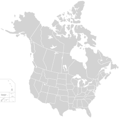
English: Blank SVG map of USA and Canada with state and province borders. Hawaii has been moved closer to the mainland USA to reduce width of image.
Non-contiguous parts of a states/provinces are "grouped" together with the main area of the state/provinces, so any state/provinces can be coloured in completion with one click anywhere on the state/provinces's area. Also, all states/provinces have a "id" attached to them, making them easy to find. Select "find" and then enter in the state/provinces's ISO 3166-2 code in the "id" field to find it. The codes can be found here (Canada) and here (USA). |
| תאריך יצירה | |
| מקור |
|
| יוצר | Lokal_Profil |
| אישורים והיתרים (שימוש חוזר בקובץ זה) |
הקובץ הזה מתפרסם לפי תנאי רישיון קריאייטיב קומונז ייחוס-שיתוף זהה 2.5 כללי. ייחוס: Lokal_Profil
|
| גרסאות אחרות |
This vector image includes elements that have been taken or adapted from this file:
The same as this map with the two-letter state or province name label for each one |
היסטוריית הקובץ
ניתן ללחוץ על תאריך/שעה כדי לראות את הקובץ כפי שנראה באותו זמן.
| תאריך/שעה | תמונה ממוזערת | ממדים | משתמש | הערה | |
|---|---|---|---|---|---|
| נוכחית | 04:48, 23 בנובמבר 2020 | | 512 × 512 (104 ק"ב) | Ponderosapine210 | Accidentally uploaded wrong version. Here is the correct one. |
| 04:38, 23 בנובמבר 2020 |  | 596 × 512 (132 ק"ב) | Ponderosapine210 | Added the prominent islands of Manitoulin (Ontario) and Isle Royale (Michigan) to the Great Lakes. | |
| 01:59, 2 ביוני 2019 |  | 512 × 512 (99 ק"ב) | Fluffy89502 | added territories | |
| 00:18, 9 בדצמבר 2007 |  | 1,730 × 1,730 (212 ק"ב) | Lokal Profil | Code trimming | |
| 07:21, 3 ביולי 2007 |  | 1,730 × 1,730 (213 ק"ב) | Lokal Profil | {{Information |Description={{en|Blank SVG map of USA and Canada with state and province borders. Hawaii has been moved closer to the mainland USA to reduce width of image.}} Non-contiguous parts of a states/provinces are "grouped" together with the main a |
שימוש בקובץ
![]() אין בוויקיפדיה דפים המשתמשים בקובץ זה.
אין בוויקיפדיה דפים המשתמשים בקובץ זה.
שימוש גלובלי בקובץ
אתרי הוויקי השונים הבאים משתמשים בקובץ זה:
- שימוש באתר en.wikipedia.org
- שימוש באתר fr.wikipedia.org