
קובץ:Atlit1870s.jpg

לקובץ המקורי (806 × 801 פיקסלים, גודל הקובץ: 115 ק"ב, סוג MIME: image/jpeg)
| זהו קובץ שמקורו במיזם ויקישיתוף. תיאורו בדף תיאור הקובץ המקורי (בעברית) מוצג למטה. |
תקציר
| תיאור |
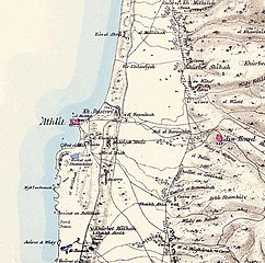
English: Portion of map produced by the Survey of Western Palestine, first published in 1880 by the Committee of the Palestine Exploration Fund. The editor, Walter Besant, died in 1901. |
| תאריך יצירה | |
| מקור | map produced by the Survey of Western Palestine, first published in 1880 by the Committee of the Palestine Exploration Fund |
| יוצר | Walter Besant, died in 1901 |
רישיון
|
יצירה זו נמצאת בנחלת הכלל במדינת המקור ובמדינות אחרות בהם תקופת זכויות היוצרים היא משך חיי היוצר ו-70 שנה (או פחות) מפטירתו.
| |
| הקובץ הזה זוהה כקובץ חופשי מכל מגבלה ידועה תחת חוק זכויות היוצרים, כולל כל הזכויות הקשורות והסמוכות. | |
| Annotations | This image is annotated: View the annotations at Commons |
היסטוריית הקובץ
ניתן ללחוץ על תאריך/שעה כדי לראות את הקובץ כפי שנראה באותו זמן.
| תאריך/שעה | תמונה ממוזערת | ממדים | משתמש | הערה | |
|---|---|---|---|---|---|
| נוכחית | 01:40, 18 בדצמבר 2006 | | 801 × 806 (115 ק"ב) | Zero0000 | Portion of map produced by the Survey of Western Palestine, first published in 1880 by the Committee of the Palestine Exploration Fund. The editor, Walter Besant, died in 1901. |
שימוש בקובץ
הדף הבא משתמש בקובץ הזה:
שימוש גלובלי בקובץ
אתרי הוויקי השונים הבאים משתמשים בקובץ זה:
- שימוש באתר de.wikipedia.org
- שימוש באתר en.wikipedia.org
- שימוש באתר fr.wikipedia.org
- שימוש באתר id.wikipedia.org
- שימוש באתר ml.wikipedia.org
- שימוש באתר pl.wikipedia.org
- שימוש באתר www.wikidata.org