
קובץ:Ancient Germania - New York, Harper and Brothers 1849.jpg
לקובץ המקורי (1,964 × 1,619 פיקסלים, גודל הקובץ: 841 ק"ב, סוג MIME: image/jpeg)
| זהו קובץ שמקורו במיזם ויקישיתוף. תיאורו בדף תיאור הקובץ המקורי (בעברית) מוצג למטה. |
תקציר
| תיאור |
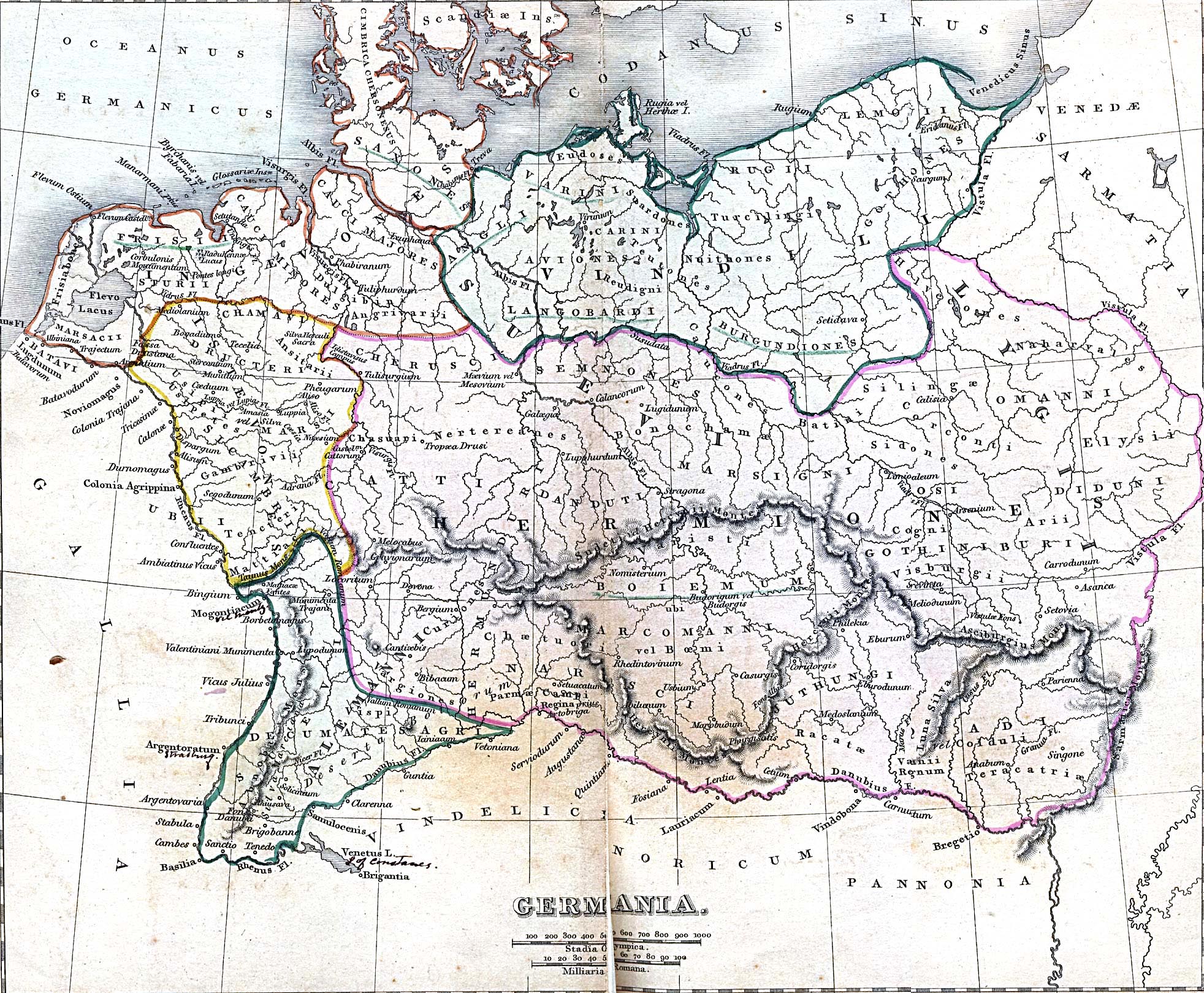
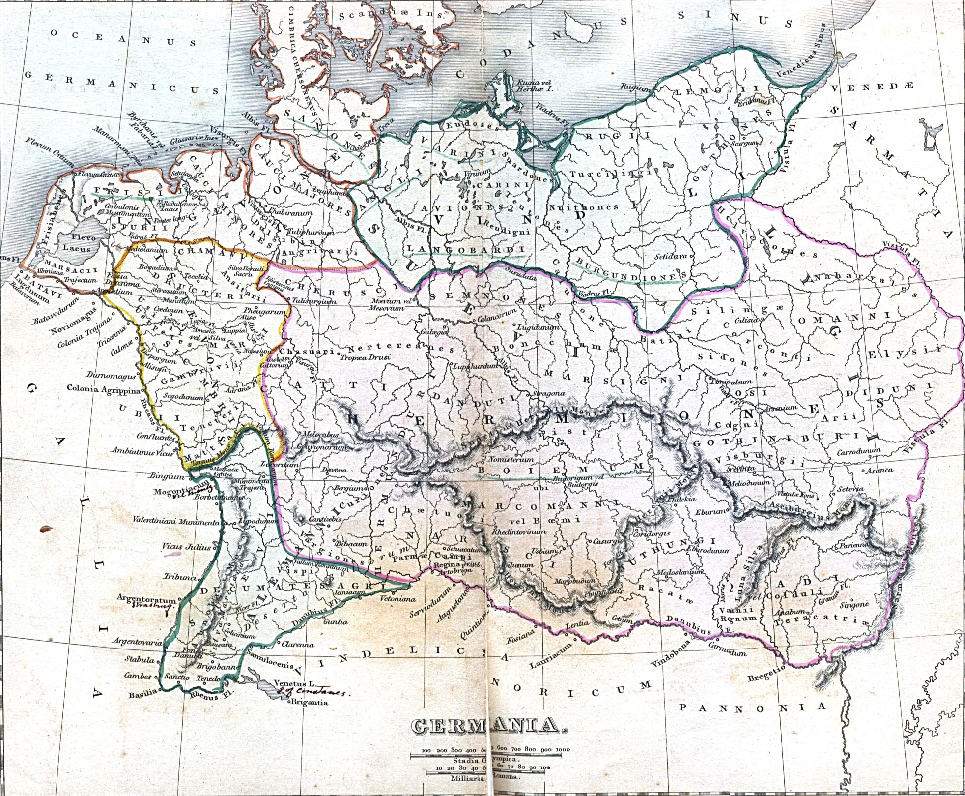
English: Ancient Germania From A Classical Atlas of Ancient Geography by Alexander G. Findlay. New York, Harper and Brothers, 1849. |
| תאריך יצירה | |
| מקור | http://www.lib.utexas.edu/maps/historical/, description: ./history_europe.html, map: ./ancient_germania.jpg |
| יוצר | Alexander G. Findlay |
| אישורים והיתרים (שימוש חוזר בקובץ זה) |
PD-old |
| Comment | By admission of the author himself, the map does not represent a specific era, but rather a very long period. [1] |
רישיון
|
יצירה זו נמצאת בנחלת הכלל במדינת המקור ובמדינות אחרות בהם תקופת זכויות היוצרים היא משך חיי היוצר ו-70 שנה (או פחות) מפטירתו.
| |
| הקובץ הזה זוהה כקובץ חופשי מכל מגבלה ידועה תחת חוק זכויות היוצרים, כולל כל הזכויות הקשורות והסמוכות. | |
היסטוריית הקובץ
ניתן ללחוץ על תאריך/שעה כדי לראות את הקובץ כפי שנראה באותו זמן.
| תאריך/שעה | תמונה ממוזערת | ממדים | משתמש | הערה | |
|---|---|---|---|---|---|
| נוכחית | 17:21, 12 במאי 2005 | | 1,619 × 1,964 (841 ק"ב) | Luestling~commonswiki | Ancient Germania<br>From ''A Classical Atlas of Ancient Geography'' by Alexander G. Findlay. New York, Harper and Brothers, 1849 {{PD}} Category:Historical maps |
שימוש בקובץ
הדף הבא משתמש בקובץ הזה:
שימוש גלובלי בקובץ
אתרי הוויקי השונים הבאים משתמשים בקובץ זה:
- שימוש באתר af.wikipedia.org
- שימוש באתר ast.wikipedia.org
- שימוש באתר bg.wikipedia.org
- שימוש באתר br.wikipedia.org
- שימוש באתר ceb.wikipedia.org
- שימוש באתר cs.wikipedia.org
- שימוש באתר da.wikipedia.org
- שימוש באתר de.wikipedia.org
- Germanen
- Waren (Müritz)
- Pommerellen
- Chauken
- Bützow
- Darłowo
- Kalisia
- Germania magna
- Wikipedia:Fotowerkstatt/Archiv 3
- Wikipedia:WikiProjekt Braunschweig/Braunschweigische Geschichte
- Römisch-Germanische Kriege
- Diskussion:Deutsche/Archiv/1
- Benutzer:Thombansen/Artikel in Überarbeitung 1
- Wikipedia:WikiProjekt Germanen/Toponymie
- Loupfourdon
- Benutzer:Methodios/Kalisia
- שימוש באתר de.wiktionary.org
- שימוש באתר en.wikipedia.org
- שימוש באתר en.wiktionary.org
- שימוש באתר eo.wikipedia.org
- שימוש באתר es.wikipedia.org
- שימוש באתר fr.wikipedia.org