
קובץ:Albania Japan Locator.png

גודל התצוגה המקדימה הזאת: 800 × 351 פיקסלים. רזולוציות אחרות: 320 × 140 פיקסלים | 640 × 281 פיקסלים | 1,425 × 625 פיקסלים.
לקובץ המקורי (1,425 × 625 פיקסלים, גודל הקובץ: 64 ק"ב, סוג MIME: image/png)
| זהו קובץ שמקורו במיזם ויקישיתוף. תיאורו בדף תיאור הקובץ המקורי (בעברית) מוצג למטה. |

|
קיימת תמונה חדשה תמונה זו בגרסה וקטורית בפורמט "SVG". יש להחליף את התמונה הנוכחית בתמונה החדשה.
File:Albania Japan Locator.png → File:Albania Japan Locator.svg
למידע נוסף אודות גרפיקה וקטורית, אנא קראו אודות המעבר של ויקישיתוף לתמונות בפורמט SVG. ראו גם מידע אודות התמידה של מדיה-ויקי בתמונות בפורמט SVG. |
 |
תקציר
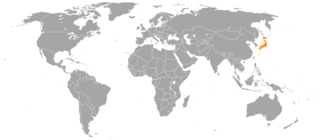
| תיאור | Locator map showing Albania and Japan |
| תאריך יצירה | (UTC) |
| מקור |
קובץ זה הוא יצירה נגזרת של: BlankMap-World6, compact.svg: |
| יוצר |
|
| זוהי תמונה מרוטשת, זאת אומרת שהתמונה שונתה בצורה דיגיטלית מהמקור. Modifications: Highlight Albania and Japan. את התמונה המקורית ניתן לראות ב: BlankMap-World6, compact.svg. השינוי בוצע על ידי Tobyc75.
|
רישיון
אני, בעל זכויות היוצרים על עבודה זו, מפרסם בזאת את העבודה תחת הרישיון הבא:
| ברצוני, בעלי זכויות היוצרים על יצירה זו, לשחרר יצירה זו לנחלת הכלל. זה תקף בכל העולם. יש מדינות שבהן הדבר אינו אפשרי על פי חוק, אם כך: אני מעניק לכל אחד את הזכות להשתמש בעבודה זו לכל מטרה שהיא, ללא תנאים כלשהם, אלא אם כן תנאים כאלה נדרשים על פי חוק. |
יומן העלאה מקורי
This image is a derivative work of the following images:
- File:BlankMap-World6,_compact.svg licensed with PD-self
- 2012-08-25T19:32:02Z Kpengboy 940x415 (1518021 Bytes) Reverted to version as of 16:35, 13 February 2012 (there's a reason the code wasn't "optimised". re-add transparency if you think it's better)
- 2012-04-17T20:57:52Z Fred the Oyster 940x415 (837212 Bytes) Corrected my faux pas with the upper and lower margins
- 2012-04-17T20:13:20Z Fred the Oyster 940x490 (837200 Bytes) Optimise code, re-introduce transparency
- 2012-02-13T16:35:10Z Smurfy 940x415 (1518021 Bytes) South Sudan assigned proper country code ss
- 2011-07-21T10:51:07Z EmilJ 940x415 (1518021 Bytes) fix position of Marshall Islands, per [[File talk:BlankMap-World6.svg#Marshall Islands]]
- 2011-07-09T19:55:11Z Smurfy 940x415 (1517991 Bytes) Reverted to version as of 17:18, 9 July 2011
- 2011-07-09T19:54:56Z Smurfy 940x415 (1517991 Bytes) No changes, just attempting to make thumbnails update
- 2011-07-09T17:18:56Z Smurfy 940x415 (1517991 Bytes) Added South Sudan with code "qx" as per BlankMap-World6.svg
- 2010-05-24T23:02:45Z Saftorangen 940x415 (1515385 Bytes) To match the original map: "Grey move : B9B9B9 to E0E0E0 according to wikipedia convention." See the [[:commons:File_talk:BlankMap-World6.svg#Color_update_need|file talk of BlankMap-World6.svg]].
- 2009-10-12T06:40:51Z Fibonacci 940x415 (1515385 Bytes) Same fixes as for the full map.
- 2008-12-02T18:21:18Z Lokal Profil 940x415 (1518276 Bytes) Reverted to version as of 14:51, 13 June 2008, new image has non of the complexity (i.e. colouring abilities etc.) of the old
- 2008-12-02T17:29:39Z Harbin 1326x601 (176022 Bytes)
- 2008-12-02T17:26:08Z Harbin 1425x625 (189017 Bytes)
- 2008-06-13T14:51:25Z Lokal Profil 940x415 (1518276 Bytes) Syncing with [[:Image:BlankMap-World6.svg]] version (01:30, March 29, 2008). Sadly enough the validator does not seem to like rdf element of the metadata although it should work acording to http://www.w3schools.com/rdf/rdf_ma
- 2008-02-08T20:55:35Z CarolSpears 940x415 (1528750 Bytes) validated, maybe
- 2007-12-14T19:51:17Z Lokal Profil 940x415 (1529675 Bytes) Readded an ocean object but this one is square instead of the original elliptic one
- 2007-12-14T19:19:56Z Lokal Profil 940x415 (1529845 Bytes) {{Information |Description=Detailed SVG map with grouping enabled to connect all non-contiguous parts of a country's territory for easy colouring. Smaller countries can also be represented by larger circles to show their data
Uploaded with derivativeFX
היסטוריית הקובץ
ניתן ללחוץ על תאריך/שעה כדי לראות את הקובץ כפי שנראה באותו זמן.
| תאריך/שעה | תמונה ממוזערת | ממדים | משתמש | הערה | |
|---|---|---|---|---|---|
| נוכחית | 21:53, 16 בינואר 2017 | | 625 × 1,425 (64 ק"ב) | Aquintero82 | Updated map |
| 04:26, 12 בספטמבר 2012 |  | 883 × 2,000 (205 ק"ב) | Tobyc75 | {{Information |Description ={{en|1=dummy}} |Source =dummy |Author =dummy |Date = |Permission = |other_versions = }} |
שימוש בקובץ
הדף הבא משתמש בקובץ הזה:
שימוש גלובלי בקובץ
אתרי הוויקי השונים הבאים משתמשים בקובץ זה:
- שימוש באתר bn.wikipedia.org
- שימוש באתר en.wikipedia.org
- שימוש באתר es.wikipedia.org
- שימוש באתר fa.wikipedia.org
- שימוש באתר www.wikidata.org